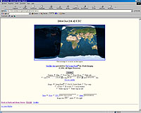
Viewing the Earth
You can view either a map of the Earth showing the day and night regions at
this moment, or view the Earth from the Sun, the Moon, the night side of the Earth, above
any location on the planet specified by latitude, longitude and altitude, from a satellite
in Earth orbit, or above various cities around the globe. Images can be generated based on
a full-colour image of the Earth by day and night, a topographical map of the Earth,
up-to-date weather satellite imagery, or a composite image of cloud cover superimposed on
a map of the Earth, a colour composite which shows clouds, land and sea temperatures, and
ice, or the global distribution of water vapour. Expert mode allows you additional control
over the generation of the image. You can compose a custom request with frequently-used
parameters and save it as a hotlist or bookmark item in your browser.